The Reading the River publication has been authored by the Lower Goulburn River Selected Area team of the Flow-MER Program. The work of the Lower Goulburn River Selected Area team is to assess how environmental and consumptive flows are affecting the ecosystem of the Lower Goulburn/Kaiela River, to help waterway managers to protect and enhance this vital water source into the future.
Winter Update | 2023
Reading the Goulburn River
Reading the Goulburn River
“Life is good, but it’s better on rivers.”
Explore the Lower Goulburn River as it changes through the seasons.
COVER STORY
River lives the high life this winter!
The Goulburn River is currently running higher than usual as a result of rainfall run-off and operational releases from Lake Eildon. Historically, the winter-spring period is when we see higher rainfall in the Southern Murray-Darling Basin and this year is proving no exception. What is different this year is that rain is falling on wetter catchments, and dams are fuller than usual after three wet years. This means that catchments are seeing increased run-off when it does rain, while dam operators are also having to make releases to ensure there is capacity to capture higher flows from headwater streams. These are referred to as airspace releases.
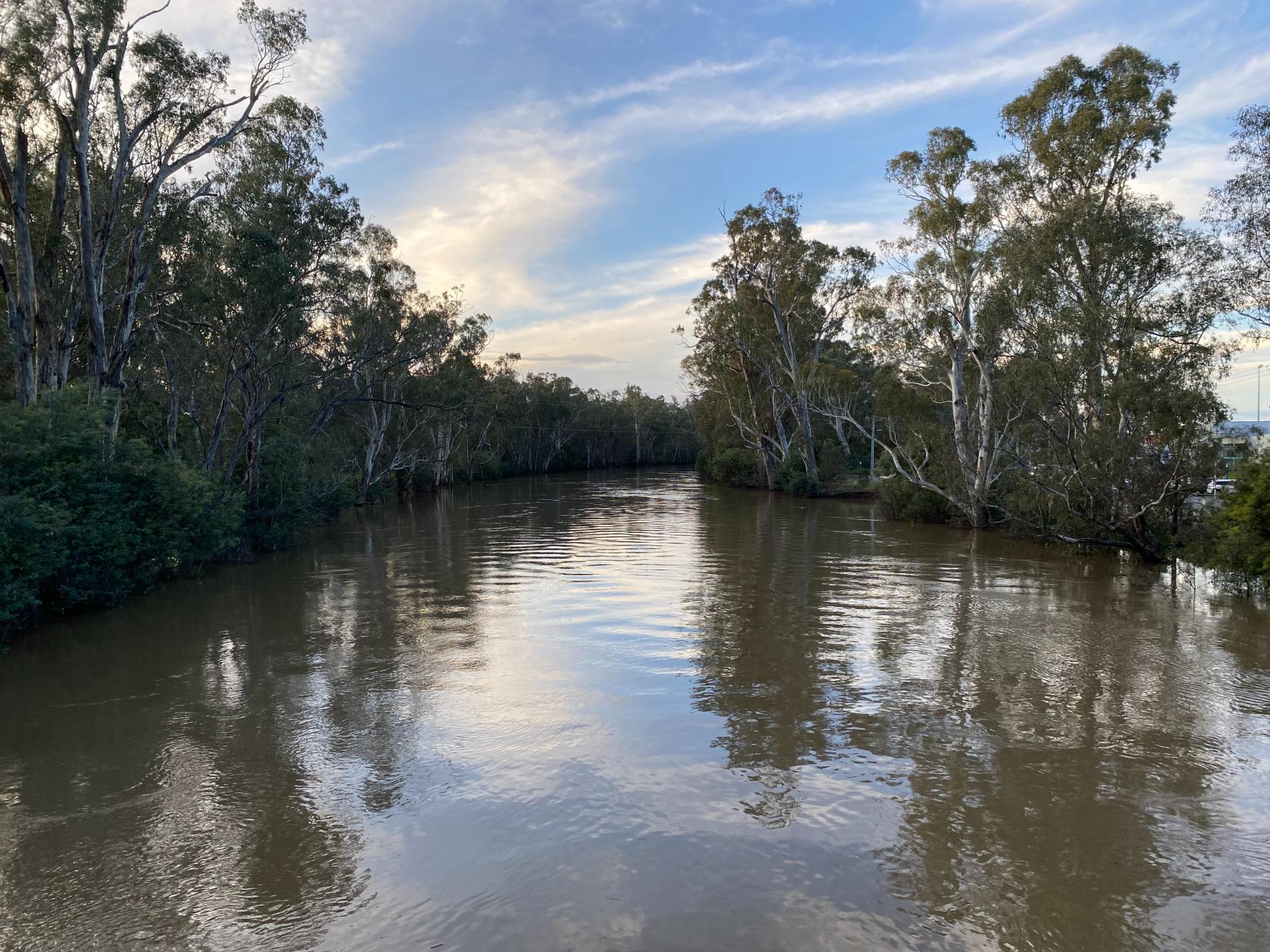
At the time of writing (June), the Goulburn River is running at approximately 20,000 megalitres per day (ML/d) at Murchison, well above the usual managed winter low flow of 1,000 ML/d. There is currently no environmental water or Inter Valley Transfers being made as part of these releases, and current flows are simply referred to as ‘unregulated’ flows.
For more information on future water for the environment use, read further below.
If you’re curious about flow rates and recent rainfall, you can check the latest information on the Bureau of Meteorology website at Goulburn Broken Rainfall and River Conditions (bom.gov.au).
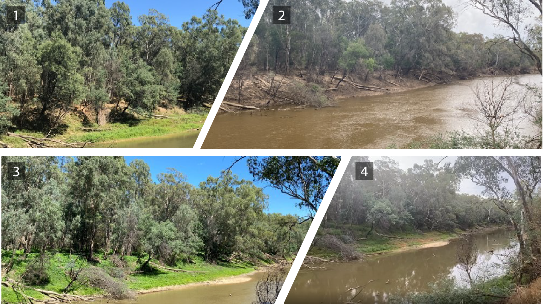
Photo point monitoring of vegetation at Shepparton North before, during and after high flows.
Photo 1 – March 2022 (before the floods)
Photo 2 – December 2022 (just after the floods)
Photo 3 – February 2023 (two months after the floods)
Photo 4 – May 2023 (five months after the floods)
System shows positive signs after high flows
Vegetation impacted by the floods in 2022 was slower than usual to grow over Summer, but has since recovered and is looking very healthy. Photo point monitoring at Shepparton North highlights the lack of vegetation just after flooding and recovery on the Riverbank, with complete cover of native species in some areas. In response to water on the floodplain, native wetland plants grew and at multiple locations the floodplain understorey is densely covered with Plains Sedge (Carex bichenoviana).
Water for the environment - sometimes not using water is just as important
Our goal to achieve the best ecological outcomes for the Goulburn River by being flexible and adapting to seasonal conditions when using water for the environment was highlighted this Autumn. Unique environmental conditions following major flooding in 2022 resulted in the decision being made not to deliver the planned Autumn fresh. Scientists confirmed that the Autumn fresh was not required, as the ecological outcomes targeted for vegetation, fish and instream condition were already achieved by high flows over late spring and summer. Further to this there was concern that delivery of the fresh could have resulted in negative ecological outcomes, in particular movement of carp into the Goulburn River and impacting young vegetation still growing due to the later than usual start of low flows.
Flood Recovery reduced – 90% of parks open!
Parks Victoria have advised that as of May 2023, they have now opened or partially reopened 90% of flood and storm affected parks in Victoria. Some sites remain closed along the Goulburn River and will be opened once Parks Victoria have deemed them safe. For further updates go to the Parks Victoria website. The Flood Recovery – GB CMA – Goulburn Broken CMA website is also being updated with relevant information for the Goulburn Broken catchment.
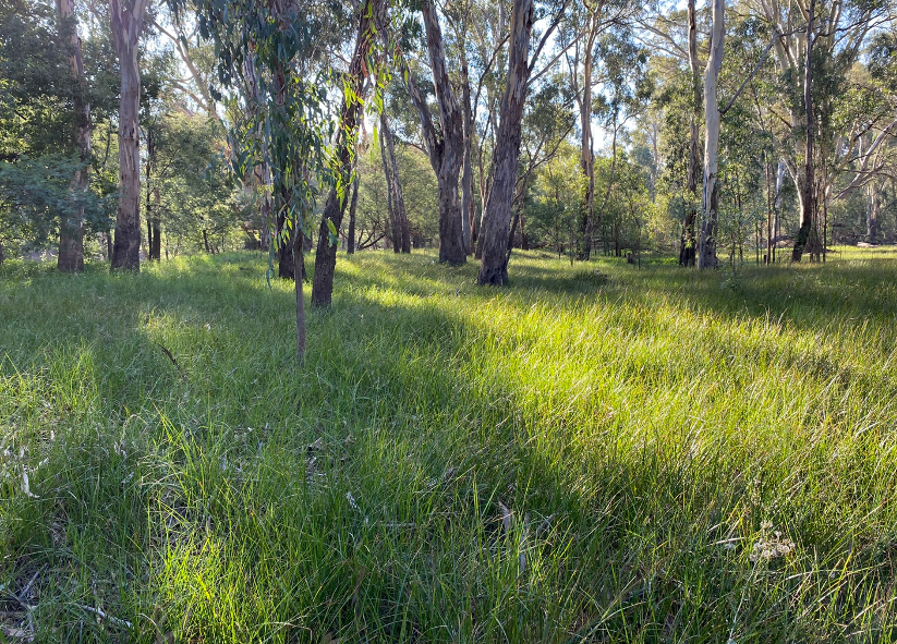
Vegetation booming on the banks and floodplain
This winter is a great time to get out and explore the floodplains. The flooding last year resulted in significant areas of floodplain now being covered with vegetation that thrives with the wetting and drying regime. The Plains Sedge (Carex bichenoviana) – a perennial sedge which grows to around 40cm in height – can be seen growing extensively across the Lower Goulburn floodplain. Typically flowering in spring, this species will be a key one to keep an eye on later this year.
Sediment deposition follows high flows
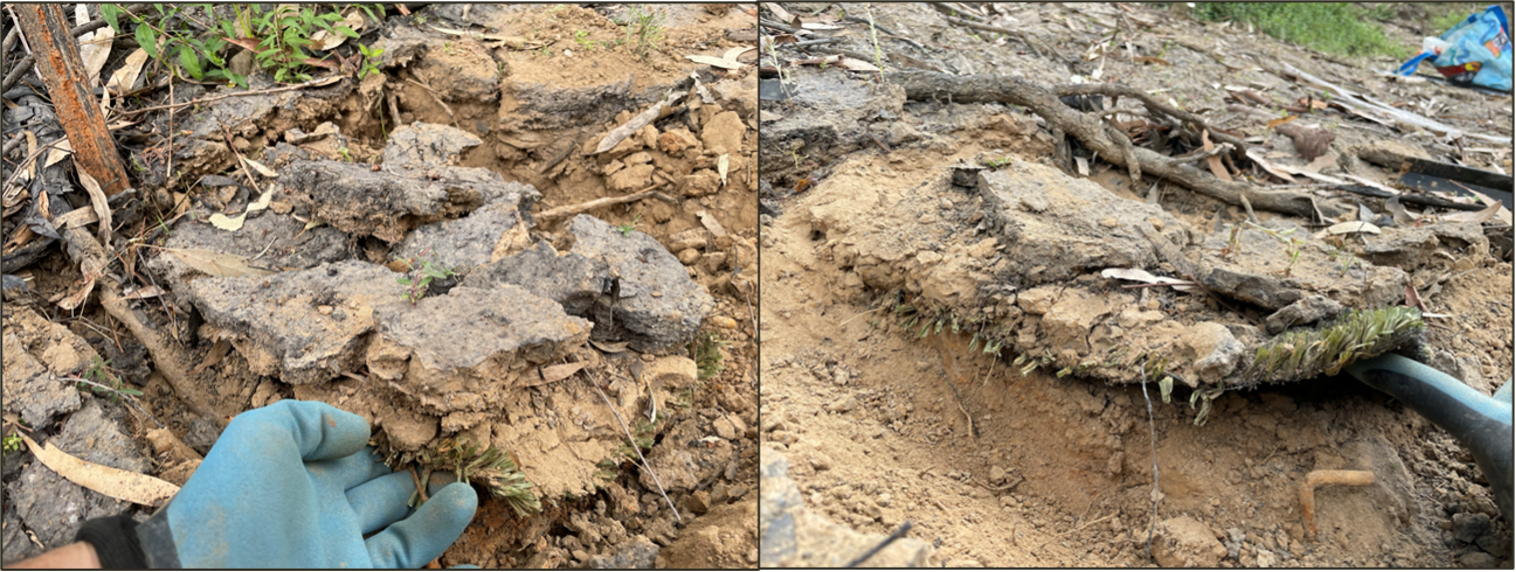
Turf mats which we use to monitor sediment and seed deposition on the riverbanks have shown a significant increase in the amount of sediment deposited post floods, compared to previous retrievals of the mats. Recent monitoring found an average of 2.3 kg of sediment retrieved post floods, compared to the average of 0.9 kg. We’re hoping higher deposits of sediment will include deposits of seeds to germinate in spring, but we’ll be watching closely as this newly deposited sediment may also be more susceptible to erosion in the coming years.

What's happening in the river this winter?
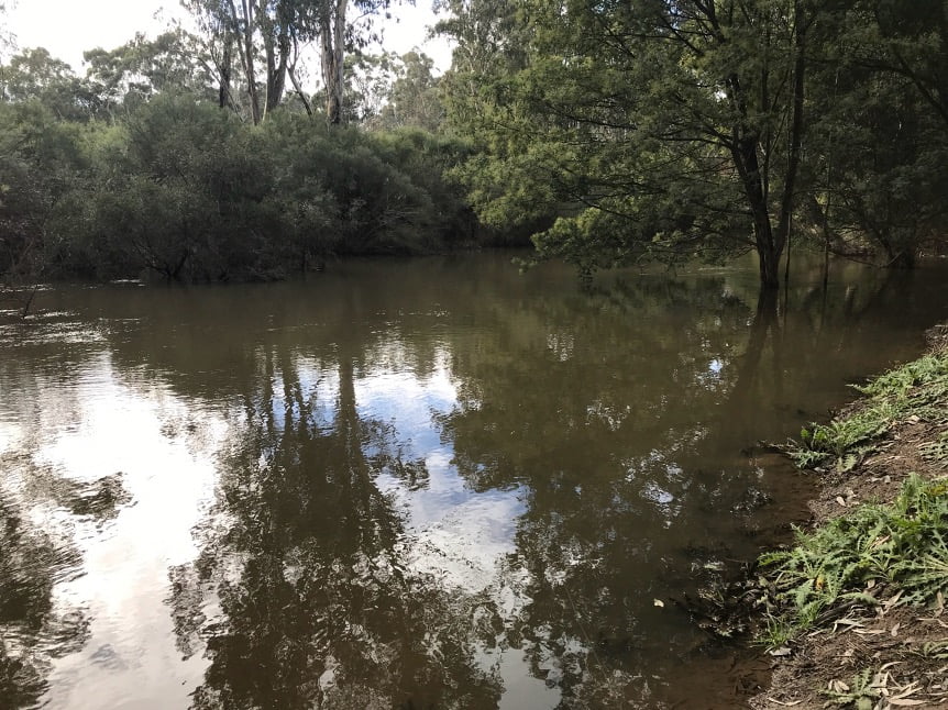
High rainfall in June resulted in large Lake Eildon inflows and increased releases to help manage storage levels. Lake Eildon releases of 10,000-12,000 ML/d occurred over the second half of June and are expected to continue throughout July.

These high releases, together with tributary inflows, have resulted in overbank flows in some parts of the mid Goulburn River (e.g. around Molesworth) and lower Goulburn River floodplain. Multiple low-lying off-channel wetlands and anabranches have been inundated and connected to the main river channel, providing access to additional habitat for native aquatic animals such as fish, platypus, frogs and waterbirds.
The high winter flows also encourage female platypus to nest higher to reduce the chance of burrows being flooded in summer when juveniles may be present. The high flows help scour bed sediments and improve instream habitat.
Freshes using environmental water are typically delivered in winter to provide these types of benefits for the river. However, this winter a managed fresh is not required as the seasonal conditions and operational releases have met these requirements.
 Once high releases subside, environmental water will be used to provide variable low flows. These will maintain habitat and food for small and large bodied fish and turtles, prior to a spring fresh delivery in a few months’ time. Slight variations are provided in the low flow rate to help minimise the risk of bank notching and erosion.
Low flows between Lake Eildon and Nagambie are planned to be between 1,000-2,000 ML/d. As Waranga Basin levels are high, these flows will continue over Goulburn Weir into the lower Goulburn River and through to the Murray River.
Winter outlook:
| June | July | August | |
| 14.1 | 13.3 | 14.9 | |
| 3.8 | 3.4 | 3.7 | |
| 39.1 | 41.2 | 45.4 | |
| 6.6 | 8.1 | 7.7 |
Averages are for Shepparton and sourced from: Climate statistics for Australian locations (bom.gov.au)
The Bureau of Meteorology has posted their winter outlook which is indicating warmer and drier conditions for south-eastern Australia in coming months. For our region, this could mean less inflows over the remainder of winter and increasing demands from water users both locally and downstream along the Murray River. Wetter catchments may see higher streamflow responses in south-eastern Australia though, so we will be keeping an eye on how catchments respond to rainfall. We encourage you to see the Bureau’s July – September outlook here.
Get to know the flows in the Goulburn River
The Goulburn-Broken CMA has developed a live hydrograph so that you can see whether flows in the river are operational flows including Inter-Valley Transfers, water for the environment, or simply unregulated flows.
See what the hydrograph looks like at the live website.
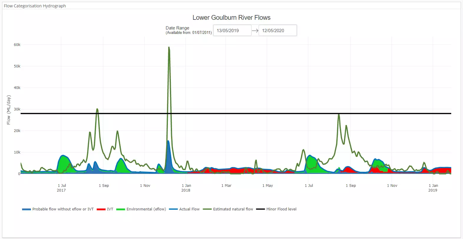
A static image of the Lower Goulburn River hydrograph showing the differences between the estimated natural flow (dark green), actual flow, and sources of water.
What are we going to be investigating this winter?
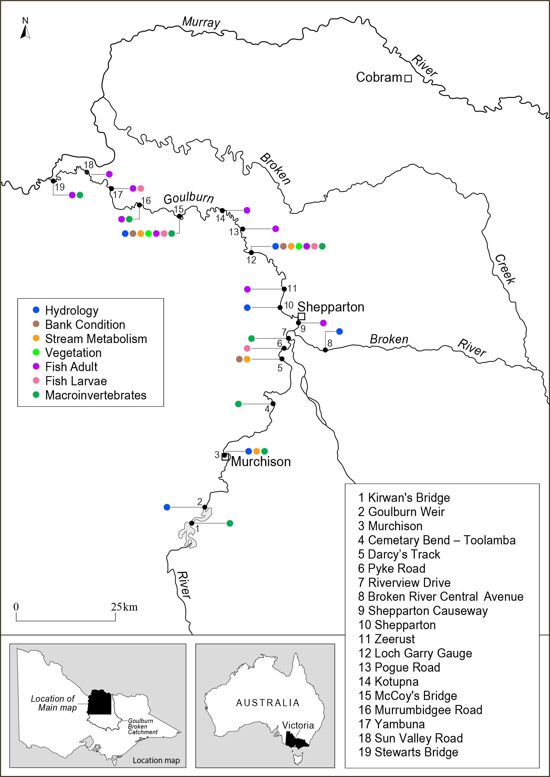
Our monitoring teams plan to be undertaking Crayfish surveys at multiple locations.

Our vegetation ecologists plan to continue Photo point surveys to monitor bank condition and vegetation responses to any planned winter freshes.
Our fish monitoring teams plan to undertake Macquarie perch surveys in the mid Goulburn River.
All survey work is subject to high flows subsiding.
Data analysis from Autumn fish monitoring will also continue, and include the recent fish population surveys conducted in May.
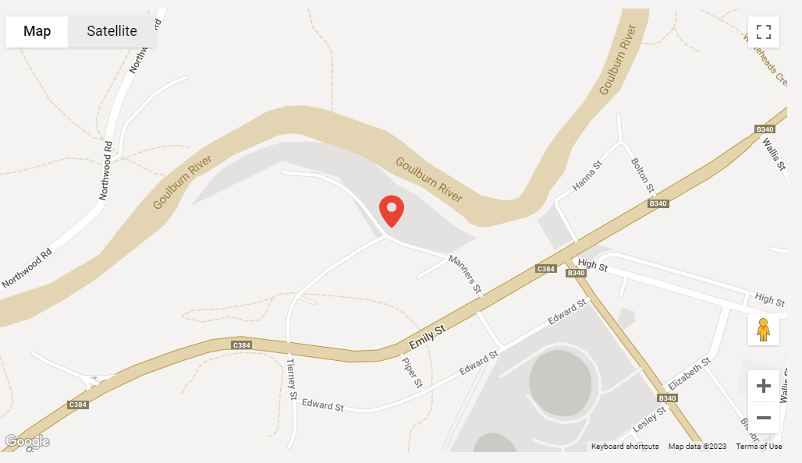
The map below shows where we will be doing our monitoring.
Eight years in — perspectives on the outcomes of environmental watering in the Lower Goulburn River
Community and scientists share their thoughts after eight years of monitoring in the lower Goulburn River.
See all videos
Community member John Pettigrew shares his views on the importance of the Goulburn River to the community and how, longer term, reconnecting the river with the floodplains will be key to having healthy and abundant aquatic life.
Fringing vegetation is critical to the health and stability of the riverbanks in the Goulburn River. Kay Morris shares what long-term monitoring has shown for bank vegetation and the importance of managing all water to sustain healthy riparian zones.
Fish Ecologist Wayne Koster shares what eight years of monitoring in the Goulburn River has taught us about the native fish in the system, and how we can manage flows to increase their numbers.
What can you look out for this winter, and where?

White-bellied Sea-Eagle
Photo source: Australian Museum
Birds of prey on the hunt for food soaring in the air or perched on a tree is a magnificent sight. Australia’s second largest bird of prey the White-bellied Sea-Eagle, was recently spotted soaring above the floodplain near Kotupna. They form permanent pairs that stay in the one area throughout the year. Reedy Swamp near Shepparton is a good spot to spy a pair of Eagles as they hunt for fish, birds or mammals. Their breeding season is from May to October so be on the look out for a large stick nest in a high tree.
Exploring your river on foot
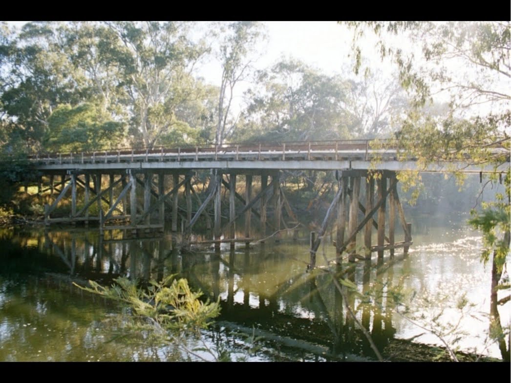
Views to be enjoyed along Goulburn River on the walk Source: Mitchell Shire and walking maps
Goulburn River Trail – Seymour
Time: 50 minutes
Length: 3.4km one way
Difficulty: Easy
Enjoy the serenity of the Goulburn River around Seymour, the walking track is suitable for bikes and prams and takes you along the Goulburn River with picnic spots to use along the way. Find out more here: Goulburn River Trail, Seymour – Walking Maps
Winter events
Stay informed of upcoming events along the Goulburn River by heading the RiverConnect website.
Visit RiverConnect
Key Environment Dates over winter:
30 July – National Tree Day
20-24 August – World Water Week
News from the broader Flow-MER Program
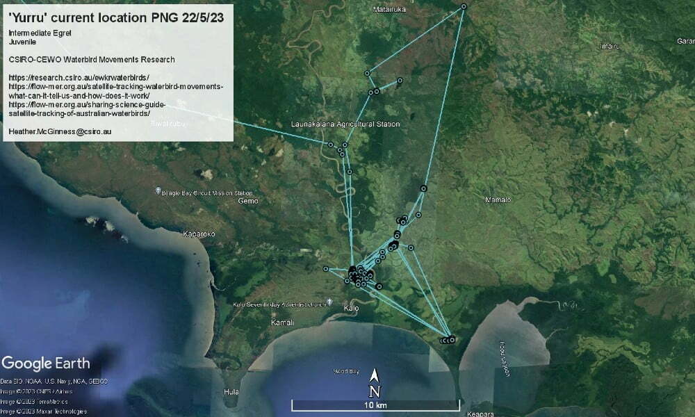
Exciting waterbird tracking update!
For the first time ever, we have GPS satellite-tracked an Intermediate Egret travelling from Australia to Papua New Guinea! This trip was documented by high-resolution GPS fixes ranging from one minute apart to one hour apart, showing the precise route and how long it took: 38 hours from coast to coast.
Evaluating how flows support native fish
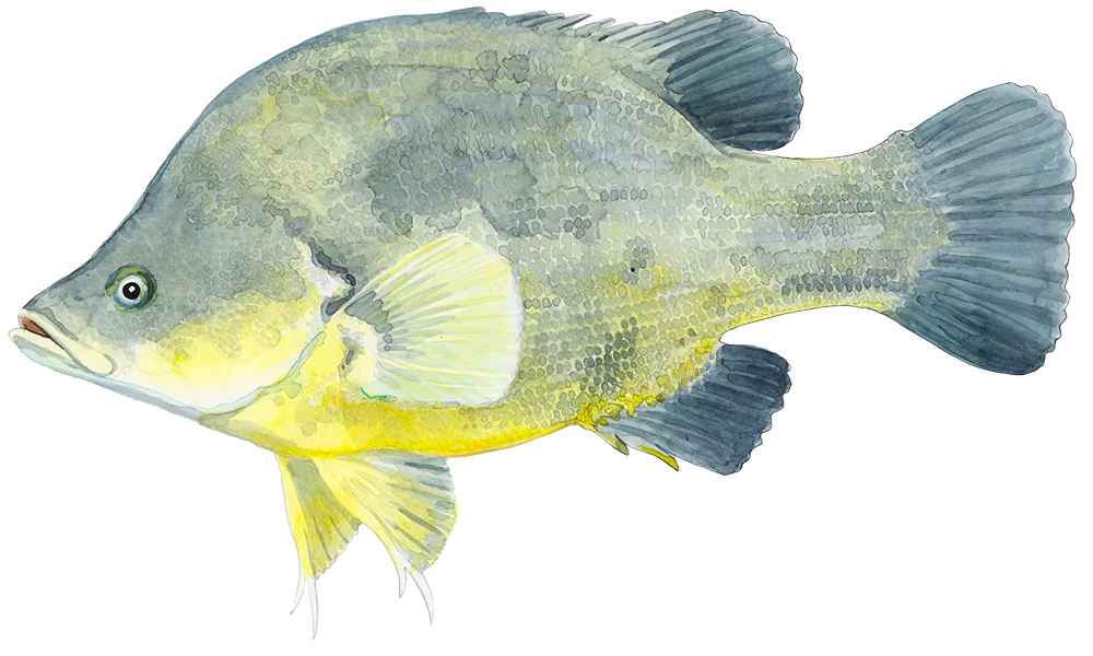
Over the past seven years, we have been monitoring and evaluating how water for the environment is being used to support native fish so that they can breed, grow and move freely. The results are promising…

The Goulburn River is known by several names as it travels first through Taungurung country in the hilly upper and middle reaches. Here, the river is called Waring.
As the river meanders downstream of Murchison and into the northern flatlands, the river winds through Yorta Yorta country. Here the river is called Kaiela, meaning ‘father of waters’. Eventually, the river flows to a confluence with the River Murray near Echuca. This confluence of rivers is known as Koninner.
We acknowledge the Traditional Owners of the country this story has been written about – Taungurung and Yorta Yorta. We pay our respects to elders past, present and emerging.
Artwork credit: Wiradjuri Artist Rebecca Salcole
Thanks for reading this Winter edition of the Goulburn Broken ‘Reading the River’ Seasonal Calendar.
Please subscribe here to receive the Spring edition in your inbox.
To learn more about the Flow-MER Program,
visit Flow-MER – Environmental Water Monitoring, Evaluation and Research


