
The Lower Murray field season goes from spring to autumn. Most field teams have their work wrapped up now, and are cleaning and maintaining the used gear. Trips yet to be completed for the 2020-21 season include the Murray cod targeted electrofishing and the category 1 annual fyke netting surveys which are scheduled to occur in April and May. During the last few months, while we were undertaking field trips to collect data and samples for the current season, we have also been analysing the data collected in 2019-20 and preparing a technical and summary report for the outcomes and learnings. It has been a great effort and our attention now shifts to getting really stuck into the 2020-21 sample analyses, data crunching and modelling.
While the in-depth analysis of the data/stats and samples (i.e. river productivity and zooplankton identification) will take some time, observations from the field and early findings give us a sneak peek into how the delivery of water for the environment influenced the plants and animals in the Lower Murray this year. Here’s a brief summary of some preliminary observations/results.


Murray cod recruitment
Murray cod spawn annually regardless of flow, but recruitment in the Lower Murray River is positively associated with flow. From 2015 up until 2020, regular recruitment to young-of-year (YOY, age < 1 year) was observed in the Lower Murray during varying flow scenarios (12,000 to 90,000 ML/day). It is likely that Murray cod recruitment is determined by survival of early life stages, which is associated with flowing waters and food availability. This indicator monitors abundance, growth, and condition of < 1 year old Murray cod, with sampling designed to collect larvae in November and juveniles in January, February and April/May each year.
In 2019-20, we sampled larger numbers of larvae and YOY (>100) relative to preceding years and in 2020-21, this cohort of now age 1+ year old individuals remains abundant. In contrast, so far this year we have found just one larvae and comparatively low numbers of YOY (<5). The reasons for the lower numbers and variation in recruitment across years is being investigated by our fish scientists.


Flow-cued spawning fish recruitment and natal origin
Monitoring for larval flow-cued spawning fish was triggered in 2020-21 when flows were predicted to surpass 18,000 ML/d, during November–December, with the possibility of reaching 20,000 ML/d. These conditions are predicted to promote spawning responses from golden perch and silver perch in the Lower Murray River.
During this season, fish eggs and larvae were sampled weekly–fortnightly from 9 November 2020 to 21 January 2021. Excitingly, in late November and early December, we collected a total of 765 perch eggs, and 152 perch larvae.
After close examination, 149 were silver perch and three were golden perch. While numbers of golden perch were lower than expected, this is the greatest number of silver perch larvae collected in the Lower Murray River since monitoring of larval fish began in the mid-2000’s and represents a great opportunity to better investigate spawning-hydrology relationships, natal origin and contribution of Commonwealth environmental water to perch spawning and larval dispersion in this region. This will be a key task for the fish team later this year.
Both silver perch and Murray cod larvae had their stomach contents removed for molecular analyses and traditional micro-invertebrate taxonomic identification, to determine what the larvae had been feeding on. They also had their otoliths extracted for analyses to find out how old they were and where they were spawned.


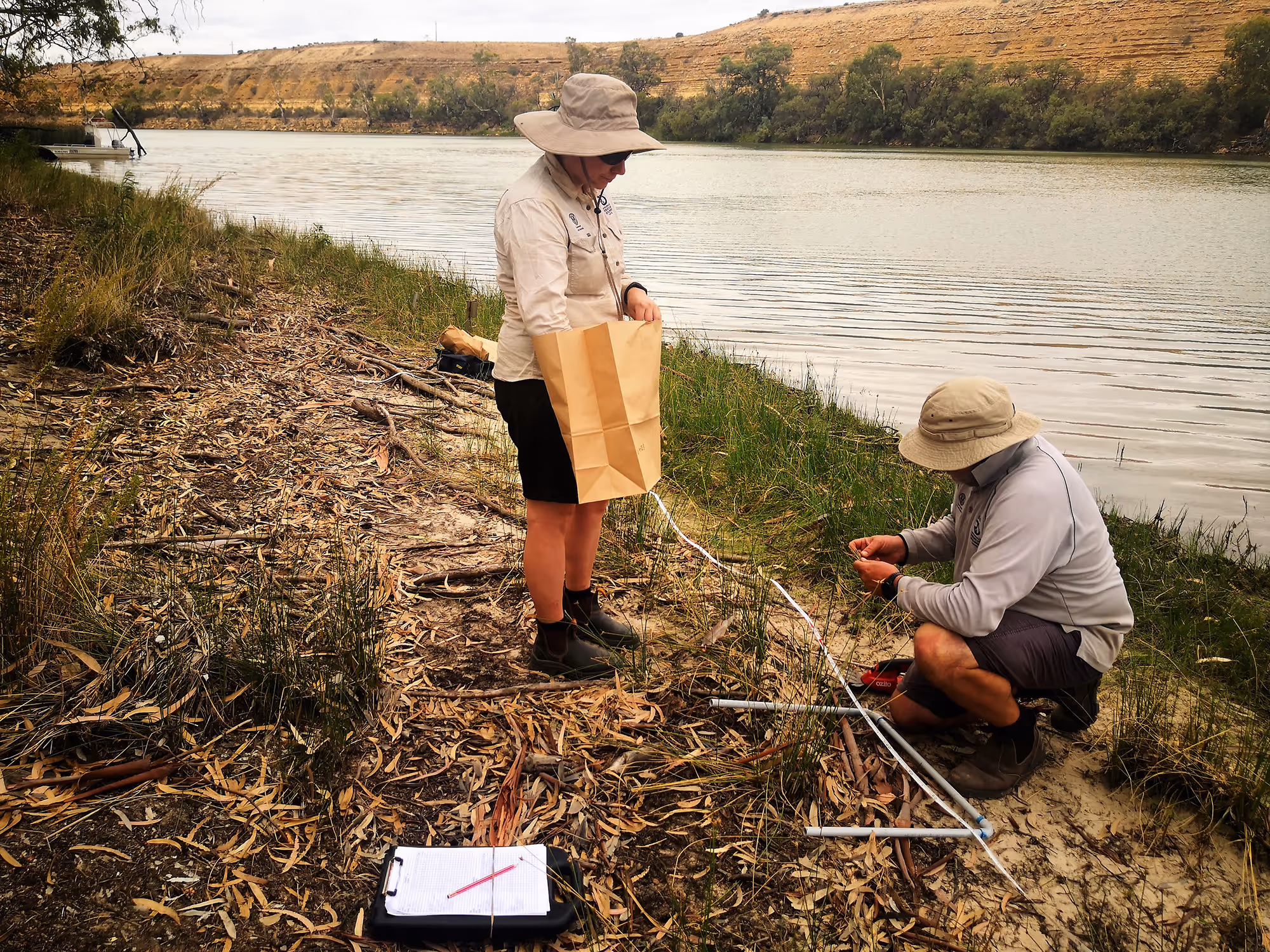
What did environmental water do for littoral vegetation?
Littoral zones extend from high water mark (rarely inundated) to riverbanks that are usually submerged. These zones are hot spots for biodiversity because they contain specialised species adapted to wetting and drying that are not found in the adjacent upland and instream ecosystems. Littoral vegetation responds rapidly to changes in water level, which makes it an ideal indicator to monitor responses/benefits of Commonwealth environmental water delivery. Monitoring took place in early February 2021, as littoral vegetation response can be better observed when water recedes.
Field observations showed that, similar to 2019-20, environmental water delivery increased native species richness and the abundance of emergent, amphibious and flood dependent vegetation species. Species richness was higher near and in the inundated areas than in areas not inundated. Lastly, most red gums seedlings found in 2019-20 were observed again in 2020-21, but no new seedlings were found at our sampling sites this season.
Communicating and engaging
A photo speaks a thousand words. It is not a secret that images are more powerful in communication than words. This happens because our brains can process images up to 60,000 times faster than words, according to Krista Neher – a marketer industry influencer. Moving images, such as in videos, are more engaging and get shared and watched more often than still images. This is exactly what we found when we launched our Flow and Fishes animation video. The Lower Murray team is extremely happy with the final product and very proud of the >18,000 views the video had (over the first three weeks). We managed to capture important concepts of riverine ecological restoration in a 4 minute video and presented them in a way that is attractive to a vast audience.
With this success, we are now working on a new animation video, aiming to describe the holistic MER Project in the Lower Murray. Also, we will soon start to select materials for the post-production of “in-field videos” as the production (image/video taking) is now finalised. We look forward to showcasing the field work performed by the skilled Lower Murray research team.
Photos below captured using drone during In-field production.

On the engagement front, we are co-designing an indigenous focus workshop at Calperum station during the second semester and plan to have field demonstration (s) at recreational fishing events (COVID-19 permitting).
Soaring higher
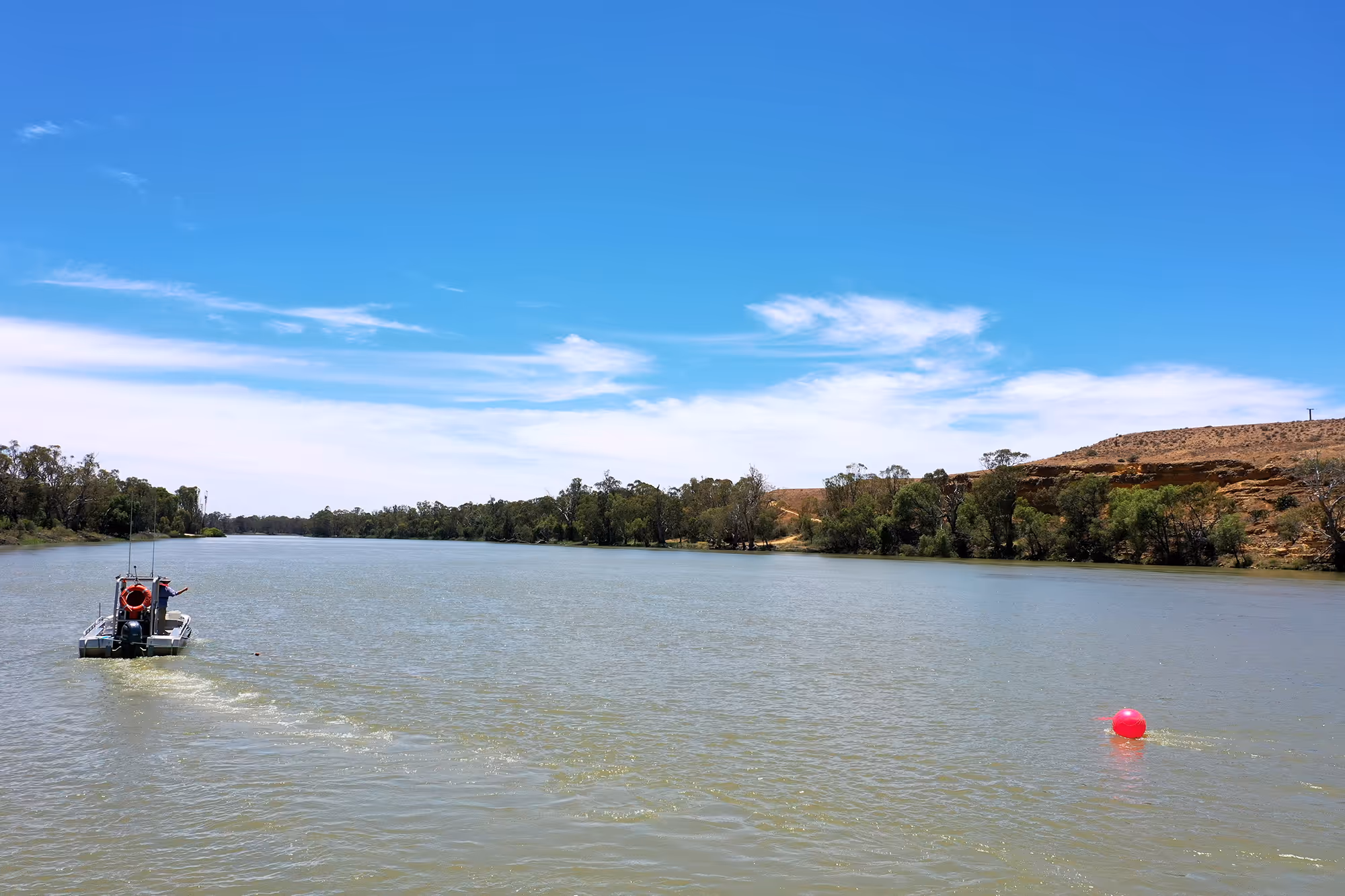
The Lower Murray team is soaring higher now with the acquisition of our new flying gadget. Remotely Piloted Aircraft (RPAs) or Unmanned Aerial Vehicles (UAVs) are names commonly used for drones, or aircraft controlled remotely by a pilot, by pre-programmed plans or even using automation systems (autonomous flights). The first “modern drone” was developed in the UK, in 1935 when Queen Bee aircraft was radio-controlled and used as aerial target for training purposes. During the Vietnam War, drones were also used on a large scale for site reconnaissance. Advancements in technology in recent decades have made drones cheaper and more capable, and as a result their use is expanding rapidly into a wide range of industries and applications.
Use of drones in science and research is becoming increasingly common, for example crop monitoring in plant breeding programs, beach surveys, monitoring bushfire experiments and monitoring marine life (whales, dolphins, dugongs, turtles and fish).

Under the CEWH Monitoring, Evaluation and Research (MER) project, there are scientists already using drones to replace traditional sampling techniques or to complement existing ones. In the Goulburn River for example, scientists have been developing a new drone-based method to monitor riverbank and vegetation condition as a measure of response to flows.
In the Macquarie Marshes wetland system, a highly significant habitat for water birds in the Murray-Darling basin, scientists are using drone imagery to undertake nest counts, derive colony boundaries, and estimate colony area at specific sites.
Our focus with drones so far, in the Lower Murray Selected Area, has been to document the diverse habitats and range of our monitoring activities in this region. Being able to capture bird eye views (picture and videos) of our field teams in action has been a powerful experience. We hope to share the products of this work in the form of “in-field” videos and others in the near future. In addition, some of our team members are getting trained to become confident drone pilots and to learn more about fauna and flora monitoring using this technique. We hope to extend the applications of drones into research and monitoring in the Lower Murray.
What’s next?
Lower Murray 2019-20 technical and summary reports are finalised and expected to be publicly available by May 2021. In coming weeks/months, we will complete the field trips for the rest of the season, including fyke netting and the targeted sampling for the recruitment of Murray cod and flow-cued spawning fish species. A range of laboratory work will continue including sorting and identification of zooplankton, Murray cod and silver perch larval gut contents analyses, otolith growth measurement and preparation for microchemistry analyses.
For engagement and communications, upcoming activities are to work on production of the “in field” videos; organise the “indigenous ecology and actions workshop”; and get started on our next animation video to explain the MER Project in the Lower Murray and highlight the important role of water for the environment in restoring the riverine ecosystem in this region.


.JPG)

.webp)