
The Yanco Creek System commences at the confluence of the Murrumbidgee River and the Yanco Creek, in the traditional lands of the Wiradjuri people. The system flows in a westerly direction through Bangerang, Yorta Yorta, Barapa Barapa and Wamba Wamba traditional country until it reaches the Edward River.
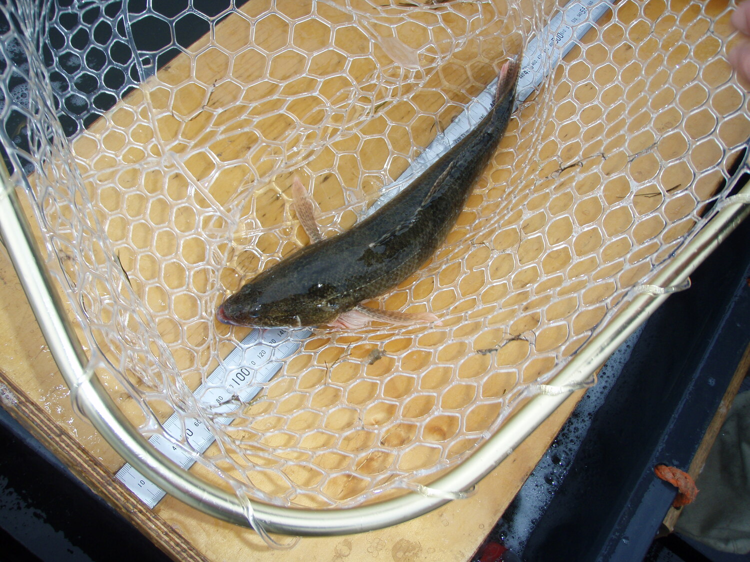
The Yanco Creek System includes large wetland and smaller floodplain depressions and billabongs, connected by a largely continuous band of riparian vegetation. It is home to a diversity of bird, vegetation, frog and native fish communities including iconic species such as Murray cod, golden perch, freshwater catfish and the threatened southern bell frog and trout cod.

Water for the environment in the Yanco Creek System
The Commonwealth Environmental Water Holder worked with the NSW Department of Planning and Environment to deliver a total of 37,387.5 ML of water for the environment in the Yanco Creek System during the 2021-22 water year.
The objectives of the water for the environment deliveries in 2021-22 were to support connectivity, maintain condition and resilience of native vegetation, provide habitat and breeding opportunities for water dependent animals and to provide refuge flows for water dependent species.
Wetland scientists from Charles Sturt University have been monitoring in the system during the 2021-22 and 2022-23 water year, at both creek and wetland sites to build a better understanding of the ecological diversity in these systems and their responses to environmental flows.
What species were found during monitoring?
Selected wetlands and creeks were surveyed for fish, turtles, frogs, tadpoles and waterbirds on four occasions between September 2021 and April 2022. This is what we found:
- 9 native fish species
- 6 frog species
- 37 waterbird species
- 3 turtle species
- 9 bat species
For full lists of identified species, please see our community report below.
Supporting our Rakali, the only top-predator in this region
Rakali (Hydromys chrysogaster), aka water rat, are a charismatic native rodent found in most permanent water sources around Australia. They are opportunistic predators that consume a wide diet including fish, crustaceans, mussels, frogs and mice. They hunt in and around the water at night and can be spotted eating their catch on logs or the river bank. As they return to the same spot to feed, a midden or feeding table can give a hint they are in the area.
Research is being conducted by Emmalie Sanders on rakali in the Yanco Creek System. With the use of traps, trail cameras and spotlight surveys, Emmalie is gathering knowledge on their behaviour and habitat use that will be useful when making management decisions on the delivery of water for the environment.
Healthy wetlands and creek systems are a valuable asset in our agricultural landscape
In Australia, the vast majority of wetlands are on private land and many contribute to the major production values of the properties where they are found. Wetlands:
- do not stand alone: they are part of a river catchment, and their health reflects the many interactions between land use, water and people that occur across the entire landscape.
- are complex and teeming with life, supporting many species of birds, amphibians, reptiles, mammals, fish and plants.
- act as giant sponges, reducing flow rates and erosion during flood events and slowly releasing water back into the environment.
- help replenish groundwater and capture nutrients before they reach the waterways, reducing the chance of algal blooms.
The Commonwealth Environmental Water Holder delivers water for the environment to target wetlands when native plants and animals need it most. This is critical to keeping rivers healthy, so they continue to sustain healthy communities. It is also key to meeting international obligations to conserve important listed wetlands.
If you would like to know more about delivery of water for the environment in the Yanco Creek system or your local region please contact our Local Engagement Officer, Michele Groat on 0427682309 or michele.groat@dcceew.gov.au.
What have we learned?
Information gathered during monitoring is used to gain a better understanding of the ecological response to delivery of water for the environment and advise management decisions for water delivery. This report contains baseline data gathered during 2021-22, which can be used to support ecological diversity in the creeks and associated wetlands and direct research in coming years.
During the 2022-23 water year, monitoring has continued in the Yanco Creek System to further build on this data set.

You can keep up to date with the monitoring occurring in the Yanco Creek System and the wider Murrumbidgee MER program through our ‘Bidgee Bulletin’ Newsletters.
The Yanco Creek and Tributaries Advisory Council Inc (YACTAC)
YACTAC’s footprint is located between Narrandera and Moulamein and includes the Yanco, Billabong, Colombo and Forest Creek network. There are nine volunteer representatives on the management team of YACTAC and over 150 landholders who contribute to the Yanco Creek System Natural Resource Management Plan (YCS Levy). The levy commenced in 2006 and is used to maintain and improve the health of the creek system. YACTAC are involved with the monitoring in the Yanco Creek System, advising on research sites, assisting with onground work, enaging with community and helping to disseminate research findings.
A number of environmental projects, including frog and platypus surveys, weed control and revegetation work have recently been conducted in the Yanco Creek System. You can read more and keep up with projects here.
Environmental projects in the YCS are managed by Andrea Mitchell, Project Officer with the Yanco Creek and Tributaries Advisory Council (YACTAC). Andrea can be contacted on env@yactac.org.au.

%20(1).webp)
.jpg)