
The Olive perchlet – a small, transparent and carnivorous fish – is listed as an endangered species in western New South Wales, and their declining status is thought to be linked to river regulation and the introduction of alien species like carp and redfin.
Until recently, only a single population was known from the Lachlan River: in the weirpool that diverts water into Lake Brewster.
Scientists working in the Lachlan have been curious about the rarity of the species, and have been quietly keeping an eye out for other populations of olive perchlet, however in the time since the Brewster population was found – in the late noughties – none have been found. But while working on a related project in the Booligal area in the colder months of mid-2023, fish ecologist Dr Adam Kerezsy finally stumbled upon a healthy population of perchlet – also called ‘glassfish’ – in a network of lakes and earthen tanks.
“I certainly wasn’t expecting them down in the Booligal area to be honest, but the nets don’t lie. Sure enough, on a cold morning in April, there they were.”
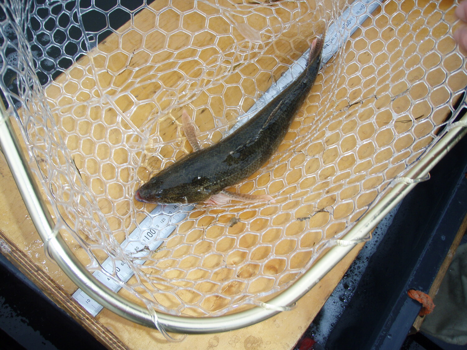
Olive perchlet get to about 5 – 6cm in length, and are a floodplain specialist, meaning they’re more likely to boom in numbers and colonise new habitats during periods of elevated flow.
“It’s likely that they’re members of the Brewster population that have moved, bred and prospered during the big floods of 2022. Alternatively, they may be a separate population that has been there all along, but that we just haven’t found because the Lachlan’s a big river, and it’s taken us until the 2020s to start surveying the more remote off-channel areas. We’ll analyse their DNA and that may help sort out the mystery”.
The initial discovery triggered additional surveys of the lower Lachlan floodplain to understand if they occurred in other locations and improve our understanding of the type of wetlands where they occur.


Kerezsy insists that the work is a joint effort and that the co-operation of a large number of organisations has been vital.
“The surveys in April were supported by the University of Canberra and the Commonwealth Environmental Water Holder. Then I went back in May and this was supported by NSW Department of Planning and Environment. In June, on another Uni Canberra and CEWH trip, I started assessing areas for translocation (moving fish to safer areas), because if we experience a dry year at least one of the lakes is at serious risk of drying. All the way along, landholder cooperation has been crucial to the processes of surveying and accessing these areas. NSW Fisheries have subsequently become involved as their support will help ensure these populations endure. This is the only way we can slowly-but-surely keep chipping away at improving the health of our rivers and the critters that we want to maintain. We all have to work together”.
Other future work includes using new techniques like eDNA to sample hard-to-access areas. The total body of gathered information will be used to inform management of the species using environmental water, particularly given the dry forecast over the next few years.
For now, it’s a fantastic outcome for the lower Lachlan River. Despite river regulation and invasive species, there are still isolated patches of habitat that can sustain populations of endangered species.
“One of my “bosses” from one of the agencies used to say to me, half-jokingly, ‘find me some perchlet!’. Well it’s taken about 15 years but it’s finally happened. The next challenge is looking after them.”

%20(1).webp)
.jpg)