fbpx

Selected Area: Lower Murray

The Lower Murray River is a complex system with diverse habitats supporting important water-dependent plants and animals. Our work here is to monitor and evaluate ecological responses to Commonwealth environmental water delivery.

Image: Murray River. Photo credit: Tanya Doody

Our work in the Lower Murray river system

Slide
Lower Murray Cultural Mural
PlayPlay

Talented First Nations artists Chloe Shorrock and Daniel Giles recently blended their two unique styles together to create a stunning mural on the River Murray and Mallee Aboriginal Corporation building in Berri. Watch and hear how their artwork tells the story of river flow and what it means to the people and animals of the region.

Slide
Indigenous Ecology in Action
PlayPlay

Our Indigenous Ecology in Action workshops aim at connecting meaningfully with the Youth of First Nations Groups. These workshops have proven to be a great way to facilitate learning on Country from ecologists, First Nations rangers and mentors.

Slide
Flow and Fishes of the Lower River Murray
PlayPlay

Flowing water is the lifeblood of our rivers. In this video, hear how well-timed seasonal flows and other management actions are helping to recover our native fish in the Lower Murray River.

Slide
Electrofishing in Action
PlayPlay

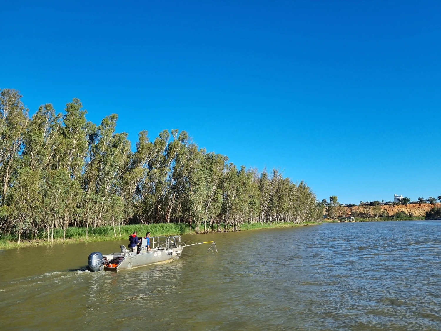
Scientists use boat electrofishing to collect data and fish samples with the aim of understanding the status of fish populations – such as species composition, age distribution, and presence of invasive species – and their response to management.

Slide
Murray Flow for the Environment
PlayPlay

Flowing water nourishes the Murray River. Hear about how water for the environment gets the river moving again and rejuvenates the plants and animals of the Lower Murray River.

Slide
Sharing our Science
PlayPlay

We use a range of techniques to measure the benefits of water for the environment. In this video, see how our staff measure fish populations, fish spawning, and vegetation responses to flows.

Slide
Restoring flows to the Lower Murray River
PlayPlay

River regulation has impacted the Lower Murray River. In this video, hear about the important role water for the environment has in restoring our rivers and what our monitoring has shown us about its effectiveness.

previous arrow
next arrow

We are honoured to work on the ancestral lands of the Ngarrindjeri, Nganguraku and Ngaiwang Nations and the First Peoples of the River Murray and Mallee. We recognise their unique ability to care for Country and their deep spiritual connection to it. We honour Elders past and present whose knowledge and wisdom has ensured the continuation of culture and traditional practices. We are committed to genuinely partner, and meaningfully engage, with Traditional Owners -their communities to support the protection of Country, the maintenance of spiritual and cultural practices and their broader aspirations in the 21st century and beyond.

Our work in the Lower Murray River

Like other river systems, flows in the Murray have been diminishing, with numerous issues such as loss of flowing water habitat, reduced connectivity, and blue-green algae, fish kills, bank erosion and river sedimentation increasing in both impact and frequency. To address these issues water for the environment is being used, and this project is helping to understand whether it is contributing to a healthier river ecosystem. We are also investigating how different plants and animals are responding to the flow volumes, timing, duration and frequency delivered through water for the environment.

The Lower Murray River is at the end of the Murray Darling Basin (MDB) system and includes the only estuary of the MDB, which connects to the Southern Ocean. Annual flow is variable, being influenced by inputs from the southern and northern basin, and rainfall and water extraction experienced in these regions.

The Lower Murray River is complex, and includes the main river channel, anabranches, floodplain / wetlands, billabongs and stream tributaries. Being towards the end of the system, the Lower Murray River is wide and deep relative to upstream reaches, and significant flow is required for floodplain inundation. Our study area covers four different zones: floodplain, gorge, swamplands and the Lower Lakes and Coorong.

Each zone has different geomorphic (landscape form) and ecological characteristics and, as a result, may require different flows to achieve environmental outcomes like fish breeding or River red gum regeneration. For example, in the floodplain zone flows need to exceed 50,000 megalitres per day (ML/d) to inundate the non-permanent wetlands, whilst in the gorge and swamplands zones, flows greater than 30,000 ML/d would have the same effect.

Daily flow (ML/d) in the Lower Murray River (LMR) at the South Australian border (blue solid line) from January 1999 to June 2019, compared to modelled flow under natural conditions (orange dashed line). Approximate bankfull flow in the main channel of the LMR is shown (grey dashed line).

These diverse habitats/zones support important water dependent plants and animals, including supporting those requiring protection under state and federal legislation such as the Murray cod, Murray hardyhead, Southern bell frog and various migratory waterbird species as well as supporting important recreational fisheries such as Golden perch and Murray cod. It is a key area for targeted environmental watering for ecological restoration, where water is delivered to re-establish or mimic key components of natural flow regimes.

Our monitoring focuses on the main channel of the Lower Murray River between the South Australian border and Wellington, with a modelling component extending to the Lower Lakes and Coorong.

Roll over the interactive map for more information:

Floodplain Zone

This zone is between the South Australian border and Lock 3. Here, the river meanders through a broad floodplain up to 8 kilometres (km) wide, with high geomorphic diversity including anabranches, backwaters and wetlands (Walker and Thoms 1993). Small wetlands, less than 50 hectares (ha) in area, make up the majority of total wetland area. Under regulated conditions, 70 percent of wetlands (approximately 7,000 ha) are permanently inundated.

Gorge Zone

This zone is between Lock 3 (Overland Corner) and Mannum. Here, the channel is characterised by long, straight reaches within a 30 metre (m) deep limestone gorge with a narrow floodplain (2–3 km wide) with geomorphology that is largely undisturbed. The Gorge zone includes numerous wetlands including the Banrock Station Ramsar site. Just under half of the total wetland area is permanently inundated, with most of the remaining area inundated at flows exceeding 30,000 ML/d.

Swamplands

Swamplands: is between Mannum and Wellington. Here, the river corridor remains confined with a narrow floodplain (1–2 km wide), but a large proportion of the floodplain has been developed for irrigated agriculture with levee banks constructed that have largely isolated the floodplain from the main river channel. This has resulted in a loss of floodplain habitat, native vegetation and natural geomorphic characteristics. There are eight wetlands more than 50 ha in size, and these represent approximately two-thirds of the total wetland area, but less than 10 percent of the total number of wetlands. Most wetlands are permanently inundated, with a small additional area inundated by flows exceeding 30,000 ML/d.

The Lower Lakes and Coorong

The Lower Lakes and Coorong is the terminal system of the MDB, and is heavily impacted by river regulation and water extractions. The Lower Lakes comprise two large, shallow, freshwater lakes, Lake Alexandrina (~65,300 ha; 1,620 GL) and Lake Albert (~17,300 ha; ~280 GL). They are physically separated from the Coorong estuary and Murray Mouth by five barrages, constructed between a series of islands from 1935 and 1940. The hydrology of the Lower Lakes is primarily influenced by inflows from the Murray River. Water levels in the Lower Lakes are managed to fluctuate seasonally, and are generally higher in winter and lower in summer following the pattern of Murray River and tributary inflows and climatic factors, such as wind, tides and evaporation (Phillips and Muller 2006).

The Coorong is a shallow (typically <3 m), narrow (<4 km) and long (about 110 km) estuarine lagoon system with a constricted channel connection (Murray Mouth) to the sea. There is a strong north-south salinity gradient in the Coorong, generally ranging from brackish/marine in the Murray Estuary near the Murray Mouth to hypersaline in the North and South lagoons (Geddes and Butler 1984; Geddes 1987).

Why this area is important?

This Selected Area is part of a large lowland river system, heavily modified by river regulation, which changed it from a riverine system to a series of weir pools. The Lower Murray River contains six of the fifteen weirs constructed since 1922, following the establishment of the River Murray Commission in 1917. The Lower Murray River is ecologically important as it connects freshwater with estuarine and marine environments and is critical to export salt out of the Basin. It also includes three wetland sites of international importance under the Ramsar Convention (Riverland Ramsar site, Banrock Station Ramsar site and the Coorong, Lakes Alexandrina and Albert Ramsar sites); and represents three of the six icon sites of The Living Murray (River Murray Channel, Chowilla Anabranch and Coorong Lower Lakes and Murray Mouth).

Our approach

Sampling and measurement

Conduct field sampling and measurements to collect on-ground data – this is the base for analysing and assessing ecological responses to flows (e.g. water quality logging and fish sampling).

To learn more, please view:

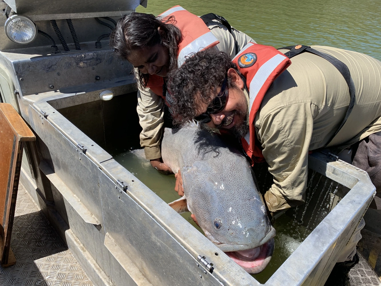
Image: George Giatas (SARDI) returning Murray cod sampled by electrofishing. Photo credit: South Australia Research and Development Institute

Analyse and interpret

Analyse data to interpret ecological responses to flow – this is how we objectively and statistically assess the link between cause (delivery of flows) and effect (e.g. increase in Golden perch spawning).

Image: The response of Gross Primary Production (GPP) to the mean irradiance (light) of the water column. Lock 6 (orange circles) and Lock 1 (blue circles) Photo credit: Rod Oliver, University of Adelaide

Model and evaluate

Undertake modelling to evaluate specific ecological outcomes – not all indicators can be measured in-situ. In this case we use ground truthing to calibrate our models and extrapolate/estimate outcomes (e.g. salt and nutrients export).

Image: Modellers Matt Gibbs (University of Adelaide) and Matt Hipsey (University of Western Australia) are discussing about flow and habitat modelling for the Lower Murray Selected Area. Photo credit: Department for Environment and Water

Share and connect

Share what we know and learned with the broader community – we believe in knowledge exchange, and we will listen to and present our findings to interested communities so that we can gain a deeper understanding about the Lower Murray.

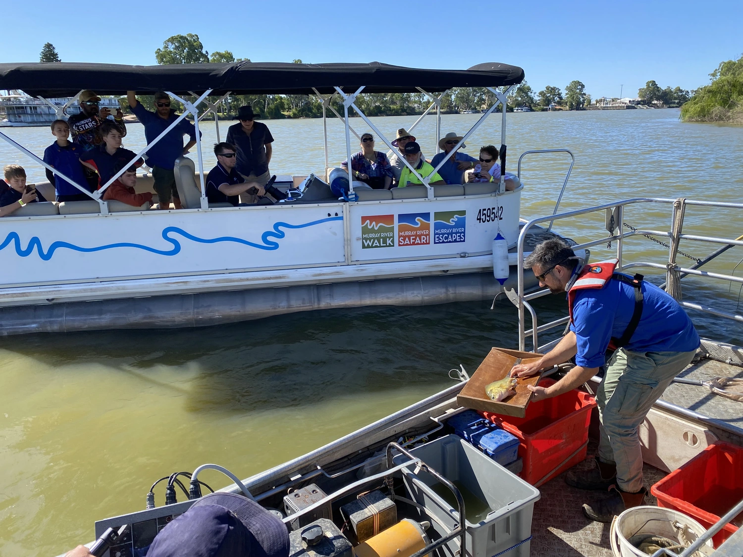
Image: Qifeng Ye (SARDI Aquatic Sciences) presenting at a Community Fish Forum in Renmark. Photo credit: South Australia Research and Development Institute

What do we monitor?

This work aims to measure the ecological responses of using water for the environment. We also aim to look deeper into those responses that we don’t yet understand, continuously improving our methods of measurement and accuracy.

We look into how water flow improves riverine hydrodynamic conditions and affects physical/chemical processes. Such processes include transport of salt, nutrients and phytoplankton through the Lower Murray River and how they are exported out of the MDB to the Southern Ocean.

We monitor how flow influences river productivity (stream metabolism and water quality), littoral vegetation and microinvertebrates. These are important in supporting aquatic food webs in the Lower Murray River. We also investigate how river flow regime and productivity influence fish spawning and recruitment, focusing on Murray cod and Golden perch.

Our team of researchers include scientists and technicians from the South Australian Research and Development Institute (SARDI), University of Adelaide, University of Western Australia, CSIRO, and Wetland Research & Management (WRM).

Chris Bice (SARDI Aquatic Sciences) retrieving a light trap used for Murray cod larvae sampling. Photo credit: South Australian Research and Development Institute
Kate Frahn (SARDI Aquatic Sciences) sampling littoral vegetation transect in the Lower Murray River. Photo credit: South Australian Research and Development Institute

Current work

Our current work is divided into several indicators or individual projects. Indicators are set to answer area specific evaluation questions, basin wide questions or both. Indicators are interlinked and location and timing of sampling overlap to provide comparable and complementary data.

Hydrology

The hydrological information collected from this part of our monitoring is used as input for the analysis of many other indicators.

Hydrological information is the record of daily discharge and water level data at stations on the main channel of the Lower Murray River. The hydrology indicator is critical as it provides fundamental information for analysis and evaluation of ecological outcomes concerning changes to the flow, particularly in times when water for the environment is being delivered. The FLOW-MER program models the changes in flow using information gathered from monitoring stations in place along the river channel.

The study is led by hydrologist Dr Matt Gibbs from University of Adelaide.

Flowing water downstream of Lock 4 (Near Loxton)

Hydraulic regime

This indicator assesses how Commonwealth environmental water contributes to increases in water discharge and level, as well as velocity.

The hydraulic characteristics (e.g. depth, water velocity and turbulence) of riverine ecosystems result from the interaction of water discharge and physical features (e.g. channel morphology (shape), woody debris, man-made structures, etc.). It is known that many aquatic biota have life histories fundamentally linked to aspects of river hydraulics, and rely on flowing water environments for parts of their lifecycle, for example, drifting eggs and larvae for distribution. Flowing habitats are, therefore, critical to ecosystem rehabilitation in the Lower Murray River, and may be achieved by two primary mechanisms:

  1. increasing discharge volumes
  2. lower weir pools

This indicator uses hydrodynamic models to estimate hydraulic parameters (e.g. discharge, water velocity and water level) to assess the contribution of Commonwealth environmental water to improving these parameters.

The study is led by hydrologist Dr Matt Gibbs from University of Adelaide.

Murray River at Lock 4. Photo credit: South Australian Research and Development Institute

Stream metabolism and water quality

This indicator monitors if and how the river is producing enough food resource to support aquatic plants and animals. More importantly, how Commonwealth environmental water is improving these conditions.

The stream or river metabolism indicator estimates the rates of photosynthesis and respiration in the water in response to the delivery of water for the environment. It is measured by monitoring the changes in the dissolved oxygen concentration over day and night cycles. These changes in concentration are caused by the balance between oxygen production, which occurs in the light (through photosynthesis), and the oxygen consumption by respiration (including decomposition) which occurs continuously.

The stream metabolism indicator provides information on the energy processed through the river food web. In addition, metabolism measurements help identify whether the sources of organic material that provide the food resources have come from within the river, or from the surrounding landscape (e.g. floodplains). These measurements describe trophic (relating to feeding and nutrition) energy connections that characterise different food web types and their capacity to support higher trophic levels, such as fish and water birds (often called carrying capacity).

The study is led by Dr Rod Oliver from University of Adelaide.

Stream metabolism site below Lock 6 in the Lower Murray. Photo credit: South Australian Research and Development Institute

Littoral vegetation diversity and productivity

This indicator compares the response of the littoral (riverbank) vegetation to different water for the environment deliveries. It compares the response of the littoral vegetation and understorey vegetation diversity and productivity across the floodplain.

The vegetation indicator is a new addition to the Lower Murray River monitoring program. It monitors diversity and productivity of vegetation in the littoral zones immediately downstream of Locks 1, 4 and 6. Sampling takes place in the tail waters, as they are places where a small amount of flow can result in a large inundation area.

The littoral zone is the part of rivers (and other waterbodies) that is close to the water. It extends from the high water mark (rarely inundated) to riverbank areas that are almost permanently submerged. These zones are considered hot spots for biodiversity because they contain specialised species adapted to wetting and drying not found in terrestrial or truly aquatic ecosystems. In addition, littoral vegetation responds rapidly to changes in water level, with most species recruiting as water levels recede.

The study is led by the plant ecologist Dr Jason Nicol from SARDI Aquatic Sciences.

Jason Nicol (SARDI Aquatic Sciences) sampling for vegetation in the littoral (shore line) zone. Photo credit: South Australian Research and Development Institute

Microinvertebrate assemblage

This indicator assesses the contribution of water for the environment to microinvertebrate density, species richness, changes in community assemblage and downstream dispersal. It also evaluates how water for the environment contributes to the quality of food resources (microinvertebrates) in foodwebs.

Microinvertebrates provide an important food source for a range of higher order consumers (e.g. fish larvae). They are also known to be rapid responders to environmental flows, particularly if they are within habitats that undergo wetting and drying cycles (e.g. littoral zones and floodplains). During wetting periods, organisms start to emerge from an egg-bank and begin to reproduce within hours after inundation. Once inundated, water that stays longer will result in higher densities, overall abundance and higher biomass of organisms. Some of these organisms are transferred to the main river channel and transported longitudinally along the river, where they then provide food resources for organisms downstream. This indicator monitors the species richness, density and community assemblage composition of microinvertebrates (zooplankton) in the Lower Murray River.

The study is led by Dr Deborah Furst from University of Adelaide.

Qifeng using a Haney Trap. Photo credit: South Australian Research and Development Institute

Flow-cued spawning fishes

This indicator assesses the contribution of water for the environment to the reproduction of Golden perch and Silver perch, as well as the population resilience of both species in the Lower Murray River. Reproduction is the natural process by which new individuals are generated (e.g. spawning) and the survival of these individuals to the juvenile life stage (e.g. recruitment).

Fishes have different flow requirements when it comes to spawning cues. For example, spawning and recruitment of Golden perch corresponds with increases in water temperature and flow discharge (in-channel or overbank). In contrast, Silver perch who live in the lotic (moving flows) reaches of the River Murray, may spawn annually. Results from the past five years of flows <18,000 ML/d (2014–2019) have revealed poor recruitment success for both species. We will be monitoring to see what happens when spring to summer flows exceed 20,000 ML/d.

The presence of Golden perch eggs or larvae has previously been used as an indicator of spawning. In this study, we will conduct egg / larval sampling at flows > 20,000 ML/d. This, in addition to young of the year (YOY) sampling, ageing and natal (home) origin assessment through otolith (fish earbone) microchemistry will provide a complete story of the recruitment dynamics of flow-cued spawning fishes in the Lower Murray River.

The study is led by the fish ecologists Chris Bice from SARDI Aquatic Sciences and Brenton Zampatti from CSIRO.

Golden Perch captured as part of fish surveys. Photo credit: South Australian Research and Development Institute

Murray Cod recruitment

This indicator assesses the contribution of the Commonwealth environmental water to the growth and body condition of Murray cod, and to the recruitment and resilience of the Murray cod populations in the Lower Murray River.

The Murray cod recruitment indicator measures the growth rates and body condition of Murray cod larvae and juveniles. It also assesses the level of recruitment (abundance of young of the year) and determines the demographics (age structure) of Murray cod populations from the Lower Murray River.

Murray cod has great recreational and cultural significance in the Murray-Darling Basin. Even so, populations have declined as result of changes in flow regimes, barrier to movement, over harvesting and habitat degradation. In the Lower River Murray, the fragmentation of the river by weirs, alteration to hydraulics and loss of fast flowing habitats are the main threats to the persistence of Murray cod populations.

Whilst Murray cod spawn annually (October–December) irrespective of flow, recruitment in the Lower Murray River main channel is positively associated with flow. Riverine hydraulics and productivity are likely related to survival of early life stages, reflecting in recruitment and abundance. Likewise, survival is influenced by enhanced growth and body condition.

The study is led by the fish ecologist Chris Bice from SARDI Aquatic Sciences.

Murray cod. Photo credit: South Australian Research and Development Institute

Fish diversity and population dynamics

This indicator was designed to address Basin-scale evaluation of fish response (large- and small-bodied) to Commonwealth environmental water.

In the Murray Darling Basin, declines in the abundance and distribution of native fish species have been associated with river regulation and other human disturbances. To help understand the influence of water for the environment on native fish species, fish assemblage data are collected using standard methods across seven Selected Areas, including the Lower Murray River, to inform the evaluation across the Basin. The data will provide summary statistics of the catch rates and population demographics for key species and a description of temporal variation in fish assemblage (characterised by composition and abundance).

The study is led by the fish ecologist Chris Bice from SARDI Aquatic Sciences.

Electrofishing boat Henri, sampling in the Lower Murray main channel. Photo credit: South Australian Research and Development Institute

Matter transport and Coorong habitat

The matter transport component assesses how Commonwealth environmental water has contributed to the transport/export of salt, nutrients and phytoplankton through the Lower Murray River. This indicator models concentrations and transport of salt, dissolved and particulate nutrients and microalgae/phytoplankton biomass (chlorophyll a).

Salinity is the measure of total dissolved salts. It is strongly influenced by flow, groundwater inputs, evapo-concentration and intrusion of seawater in estuarine habitats. Undoubtedly, salinity is an important parameter governing the distribution and abundance of aquatic biota.

Dissolved inorganic nutrients are the ones readily assimilated by biota for growth and survival. Nitrogen, phosphorus and silica are particularly important because they control the productivity of aquatic ecosystems. Particulate organic nutrients (such as nitrogen and phosphorus) are those incorporated into the issue of living and dead organisms.

Chlorophyll a is a measure of phytoplankton biomass, which is an important primary producer sustaining the food webs of riverine ecosystems.

All three components are strongly influenced by flow. Flow plays a major role exporting salt, transporting dissolved nutrients, from dried sediments and dead organic matter and increasing in phytoplankton productivity.

The Coorong Habitat component assesses if and how water for the environment improves Ruppia tuberosa and fish habitats in the Coorong, through reducing salinity and increasing water levels.

The Coorong Habitat component utilises the salinity concentrations and water level modelled data, as well as other environmental conditions, to estimate the extent of fish and Ruppia habitats in the Coorong.

Ruppia tuberosa is an important aquatic plant (macrophyte) which provides habitat for fish and food for herbivorous birds in the Coorong. The germination and growth of Ruppia is known to be influenced largely by salinity and water level, and consequently by flow regimes through the Coorong barrages (Kim et al. 2013). Salinity is also known to strongly influence the extent of estuarine fish habitat as well as influence the fish assemblage present in the Coorong. Key fish species are Mulloway, Black bream, Greenback flounder, Yelloweye mullet, Congolli, Tamar goby and Smallmouth hardyhead.

The study is led by the limnologist Professor Justin Brookes from In Fusion Consulting / University of Adelaide.

Ruppia Tuberosa. Photo credit: Natural Values Atlas
Chlorophyll a. Photo credit: Wikipedia

What we’ve learned

Over the past five years we have monitored the ecological outcomes of Commonwealth environmental water in the Lower Murray River which are summarised below.

More flowing habitats

Increased the amount of “flowing habitats” and promoted water level variability in habitats. Flowing habitats benefit native plants and animals adapted to a riverine environment, whilst variable water levels generally improves bank vegetation health and increases the diversity of biofilms (key component of riverine food webs).

Image: Biofilm. Photo credit: Live Science

Oxygen levels maintained

Assisted in maintaining good oxygen levels in the water (>5 mg/L during dry years), by increasing water mixing. This is particularly important during the main reproductive season (spring-summer), when early life stages (e.g. eggs and larvae) require adequate oxygen.

Image: Dissolved oxygen. Photo credit: Wikipedia Commons

Increased primary production

Increased primary production (microalgae), which means more food available for secondary producers (microinvertebrates/zooplankton) and consequently for fishes. Generally, it contributes to healthier food webs in the riverine system. Downstream transport of food resources benefit food webs in the Lower Lakes and the Coorong.

Image: Food webs illustration. Photo credit: Murray-Darling Basin Authority

Increased microinvertebrate diversity and density

Promoted the downstream transport of microinvertebrates (zooplankton) from upstream sources to the Lower Murray, and increased the occurence of littoral (bank) organisms in the main channel. This increased diversity (variety) and density (amount) of microinvertebrates in the Lower Murray, which meant a more diverse food source available for predators. Microinvertebrate density and species diversity is particularly important for the survival of fish larvae and other primary consumers.

Image: Rotifier (B. diversicornis). Credit: Russell Shiel, University of Adelaide

Relationship between flows and fish spawning and recruitment

Spawning of Golden perch occurred in the Lower Murray River, but no strong recruitment of Golden perch or Silver perch occurred in this region with spring–summer flows less than 18,000 megalitres per day. Both spawning and recruitment may be influenced by changes in water velocities, which are associated with changes in river flow. Future investigations will be carried out for this indicator when flows are in excess of 20,000 megalitres per day in this region.

Image: Golden perch. Photo credit: South Australian Research and Development Institute

Reduced salinity

Removed excess salt from the MDB and reduced salinities in the Coorong, by flushing salt (export) out via barrage releases and by reducing salt intrusion (import) via the Murray Mouth. For example, during the low flow years, Commonwealth environmental water delivery contributed significantly (64-87%) to salt export.

Image: Murray mouth. Photo credit: Murray Darling Basin Citizen’s Association

Flows through the barrages from the Lower Lakes into the Coorong. Photo credit: South Australian Research and Development Institute

Our team

Assoc Professor Qifeng Ye

Project Leader

Qifeng is a principal fish ecologist with extensive research experience in environmental water requirements of native fish and ecological impacts of river regulation.

Dr Matt Gibbs

Task Leader

Matt is an expert in hydrological/ hydraulic models, river restoration, uncertainty analysis, forecasting and salinity modelling.

Dr Rod Oliver

Task Leader

Rod’s work focus on population dynamics and composition of phytoplankton; and how these influence water quality, aquatic food webs and ecosystem function.

Professor Justin Brookes

Task Leader

Justin is an expert limnologist with considerable experience in developing tools to assist determining flow requirements in the MDB.

Dr Jason Nicol

Task Leader

Jason is an experienced plant ecologist with excellent knowledge of aquatic and riparian vegetation of the south-eastern Australia particularly of the MDB.

Dr Deborah Furst

Task Leader

Deborah’s work focuses on the impact of environmental water on zooplankton community dynamics and the ecology of the Murray River system.

Chris Bice

Task Leader

Chris’s research focuses on the fish movement, fish passage, threatened species ecology and the response of fishes to changing in flow regimes.

George Giatas

Flow-MER Project Officer

George is a fish ecologist with interests in ecological indicators of environmental flows, trophic dynamics and food webs.

Luciana Bucater

Engagement and Communication Coordinator

Luciana is a fish ecologist with interest in engaging with fishing and first nations communities, communicating research findings and knowledge exchanging

Anthony Moore

CEWH Manager

Anthony has worked on environmental water delivery and aquatic ecosystems policy and programs in the MDB since 2013,  He has a background in environmental science, education and natural history, and feels a strong drive to help restore the living rivers and waterways of southern Australia.  He is a CEWH Environmental Water and Lower Murray Manager.

Assoc Professor Matt Hipsey

Key Researcher

Matt is an expert in hydrodynamic-biogeochemical modelling, using models to quantify the relationships between hydrology, water quality and habitat.

Dr Russ Shiel

Key Researcher

Russ specialises in taxonomy and ecology of zooplankton and littoral microfauna, particularly responses to perturbation, and food web interactions.

Dr Brenton Zampatti

Key Researcher

Brenton is a fish ecologist with an interest in the life histories of fish and the dynamics of populations. His research in the Murray-Darling Basin concerns the impact of river flow on fish spawning, recruitment and movement, and ultimately the health of fish populations.

    Subscribe and get the latest updates in your email inbox

    This page contains information specific to the Lower Murray-Darling Commonwealth Environmental Water Holder (CEWH) Monitoring, Evaluation and Research Project. For further information about water use in the Lower Murray-Darling catchment, please click here to visit the CEWH website.

    Disclaimer

    The information on this website is presented by the Department of Climate Change, Energy, the Environment and Water (the Department) for the purposes of disseminating information to the public. It does not constitute legal or other professional advice.

    The views and opinions expressed on this website are those of the authors and do not necessarily reflect those of the Australian Government or the Portfolio Ministers for the Department or indicate a commitment to a particular course of action.

    While reasonable efforts have been made to ensure that the contents of this website are factually correct, the Commonwealth of Australia does not accept responsibility for the accuracy or completeness of its contents. The Department disclaims liability, to the extent permitted by law, for any liabilities, losses, damages and costs arising from any reliance on the contents of this website. You should seek legal or other professional advice in relation to your specific circumstances.

    Use of this website is at a user’s own risk and the Department accepts no responsibility for any interference, loss, damage or disruption to your computer system which arises in connection with your use of this website or any linked website.