Ecology and geomorphology have for a long time involved arduous days in the field, often on challenging terrain, in thick scrub, with lots of time on hands and knees. Many of you know the resulting feeling of fatigue, and the inevitable dirt under the fingernails. Some of you may even be missing these times, but that is a story for another day…
Our approaches to monitoring rivers are changing. A major development in this regard is the use of drones. Unmanned Aerial Vehicles (UAVs) or ‘drones’ have been adding value in many industries, but in waterway science and management the use, beyond pretty aerial pictures, was hard to find.
Based on international research, Streamology has been developing a new drone based riverbank and vegetation condition surveying method over the last two years. Using drones has challenged the team to push their limits across various aspects including; top gun level flying (close proximity – and the occasional crash!), increased spatial referencing (for sub-centimetre accuracy) and computational analyses that take days of computer power. The challenge has been worth it, as using drones is providing far superior insights compared with previous monitoring methods.

Why monitor riverbanks from the sky?
We know flow causes change in riverbank morphology, processes (geomorphology), vegetation zonation and condition. Rivers have adapted to this. Under hydrologic changes such as our changing climate, or flow operations, there will be a direct geomorphic or vegetative response. Irrevocable changes to riverbanks (deep incision, bank steepening or channel widening) and to vegetation (recession and removal due to prolonged inundation and high velocities) may significantly alter ecosystem function. Demonstrating a response and explicit link to the impacts of flow, allows us to understand impacts and modify management, to achieve the best outcomes for healthy rivers.
The benefit of drones for monitoring is that they enable explicit geo-referencing, something that was not previously possible. Using satellite and ground-based tracking, drones enable repeat before and after monitoring. This allows direct comparisons to be made over time between changes that can be attributed to flow conditions. For example, we can identify the loss of vegetation types and the duration of inundation, or the four phases of bank collapse under an irrigation season flow, or the influence of boat wash over the space of a day. All of these changes can be linked to our management of flow and riparian land.
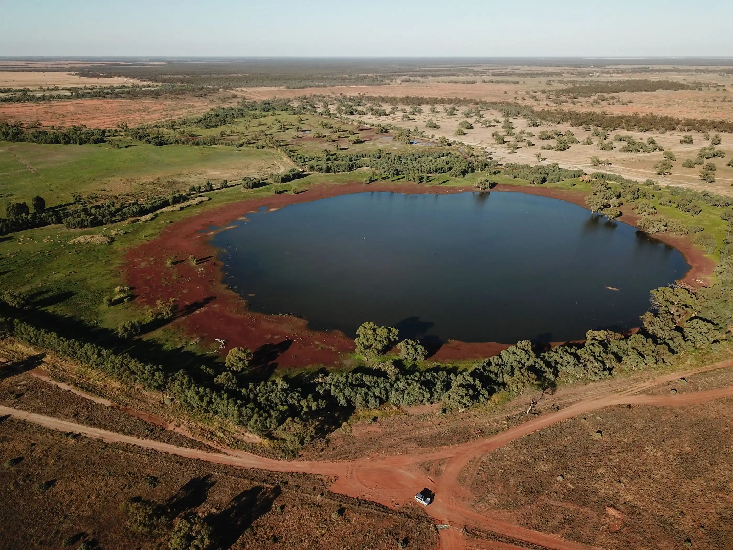
Streamology is now using drones to monitor riverbank morphology and vegetation changes on rivers throughout Victoria and New South Wales, with some of this work now part of the Flow-Monitoring, Evaluation and Research (Flow-MER) program for the Commonwealth Environmental Water Holder. We have Flow-MER sites on the Murray Darling Basin’s Goulburn River, Victoria, and Edward/Kolety–Wakool River, New South Wales. At these sites we are doing a lot more than comparing pretty pictures – we are taking a deep dive into the digital world.
When the method doesn’t exist, you need to create it
Streamology staff have been undertaking physical habitat monitoring, including hydraulic habitat (hydraulic modelling) and bank condition monitoring for almost 10 years. What started as a bespoke methodology using erosion pins on the Goulburn River in 2011, has evolved into a highly innovative and ever-advancing drone method, based on digital image capture and the resulting 3D digital model development. The approach uses photogrammetry, which can be explained by being similar to someone walking around a chair and blinking 50 times to develop in their brain a 3D image of the chair. This method has been around for some time, but it is the recent improvements to the accuracy and methods required to capture and spatially map individual plants, or erosional and depositional features, that has allowed the latest possibilities.
Riverbank changes are assessed as erosion and deposition to understand (1) the pattern of, and (2) the volume of change and how this corresponds with particular flow characteristics. To do this, two Digital Elevation Models (DEMs) of the same riverbank, before and after a flow event (or series of), are compared. This process results in a visualisation that highlights areas of deposition and erosion across a riverbank.

In this example, the model comparison highlights erosion in red and deposition in blue, allowing for the spatial analysis of geomorphological processes occurring in response to the flows experienced. The process of aligning each respective model (from each drone survey) is a crucial stage of the post-processing procedure which uses Ground Control Points (GCPs) to establish sub-centimetre accuracy. A visual representation of the depth of erosion/deposition is presented by the shading of each colour and is highlighted, in this model, on a scale ranging from -10cms to +10cms.
Vegetation changes on the other hand, are monitored using either Digital Elevation Model comparisons (or DEMODs) or 2D vegetation map comparisons. The latter uses hundreds of drone images taken from a birds-eye-view to create a 2D map. Two vegetation maps of a site (surveyed before and after a flow event) are then be compared and the spatial extent of change can be calculated in response to a particular flow event.
In this example, vegetation cover from three different drone surveys is highlighted with a different colour. In this case, on Colligen Creek, it was clear that variations in inundation periods led to significant changes in vegetation cover. These responses were then spatially quantified and linked directly to flow events.

We learnt a lot along the way
As part of the 2019/2020 Goulburn and Edward/Kolety–Wakool Flow-MER programs, this method has been used to interpret the impacts from both single flow, and multiple flow events (irrigation and environmental) on bank and vegetation condition. Data analysed using this approach has facilitated the understanding of how historic events and flow sequencing can impact processes of change within each respective waterway.
For example, it has been found within both the Edward/Kolety River and the Goulburn River, that periods of prolonged summer irrigation flows prior to an environmental flow can prepare a riverbank for mass failure (slumping) erosional events. This sequence of flow events creates a ‘notch’ (or water mark) during the prolonged irrigation period, saturating and reducing the stability of the upper bank during the rise and the fall of the subsequent large environmental flow event. The ultimate result is steeper banks and a wider channel. By avoiding the sequence of events, whilst still delivering similar flow volumes, we can reduce bank erosion and maintain habitat niches for flora and fauna.
When considering the interactions between bank sediment change, and vegetation cover and density, results have supported the general consensus that increased vegetation cover leads to improved bank stability and resilience, and conversely, increased bank stability and resilience leads to increased vegetation cover. Evidence to support the relationship between these processes prior to the development of the drone method was challenging due to the spatial limitations of transect (linear) derived vegetation monitoring.
So what? What does this all mean for environmental water delivery?
The following drone derived insights represent important advancements in understanding the historic, and potential future impacts of managed flow deliveries (both irrigation and environmental) with the Goulburn and Edward/Kolety–Wakool systems:
- Linear erosion (or notching) as a result of prolonged irrigation events during hot summer months has prepared riverbanks for future mass-erosion events.
- Environmental flow, if analysed in isolation, can be miss-attributed as the trigger for mass-erosion events due to the timing in relation to a prior irrigation period and the tendency for these flows to saturate the upper bank zone at peak flow.
- Vegetation cover and bank stability are intricately linked variables with changes in one directly impact changes in the other.
An understanding of these points has shed light on the need for state and environmental water holders to work together to design the sequence and type of flow deliveries that work to benefit the system rather than damage it. Streamology’s drone outputs have been recently used to inform the strategy for management of the Goulburn River under the operations of the Murray Darling Basin Authority. Monitoring and findings have also been used by Department of Environment, Land, Water and Planning (DELWP) and the Commonwealth Environmental Water (CEWH) with relation to water delivery monitoring along the Goulburn River and within the Edward/Kolety–Wakool system.

Whilst the image above captures a single moment in time, the picture here illustrates change over time by comparing two 3D photogrammetric models. In this example the model shows the establishment of areas of linear erosion (notches) in response to the summer monitored flow period. The dotted blue lines relate to flow delivery volumes.


The point cloud comparison of the bank above between two different periods in time is shown as a digital elevation model of difference below, and clearly highlights bank zones which are experiencing erosion (upper) versus deposition (lower). This difference model indicates how the drone method can clearly identify areas of change and enable the attribution of this change to specific water deliveries.

Where to from here?
Streamology’s drone based bank change analysis method is constantly evolving through better capture and analysis techniques. The range of questions to be addressed using these drone techniques is relatively unlimited with these new approaches. The Streamology team is monitoring riverbanks to assess the benefits of environmental flows, the response to irrigation demand flows, boat wash impacts, fire and flood impacts, and effects on indigenous sites. With a current focus on flow impacts on waterways we hope to better optimise water delivery for social and economic needs whilst protecting ecosystem and ecological functioning.